|
|||||||||
|
|
|||||||||
|
Cochran
Mill Park
|
|||||||||
|
Location
of SFARES' first annual Field Day, June 21, 22 and 23, 2002.
Location of SFARES' second annual Field Day, June 27, 28 and 29, 2003. Location of SFARES' third annual Field Day, June 25, 26 and 27, 2004. Location of SFARES' fourth annual Field Day, June 24, 25 and 26, 2005. |
|||||||||
|
|
|||||||||
 |
|||||||||
|
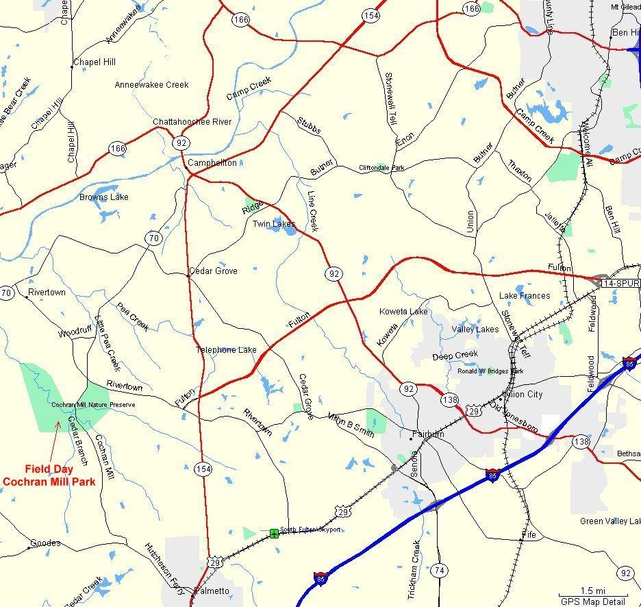
This map
will help you find the park. Click on this picture to get a larger picture
in another window
|
|||||||||
|
|||||||||
 |
|||||||||
|
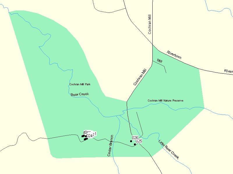
Location
of the park: Turn South
onto Cochran Mill road from Rivertown Road. Go approximately 1.1 miles
and the park entrance will be on your RIGHT. Turn right into the park
entrance and the road to the site will be straight ahead through the
gate. The welcome station will be at the top of the hill, just to the
right as you enter the park, under the picnic shelter. (Note, to see
a larger printable picture, right click the image and , in Netscape,
select view image in your browser or in IE select "save picture
as", choose a file name, save the picture and then view with something
else <another reason I don't like IE>). Park entrance at the gate
(waypoint 025 on the map) is located at GPS coordinates N33.57106°
W084.71322°.
|
|||||||||
 |
|||||||||
|
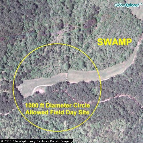
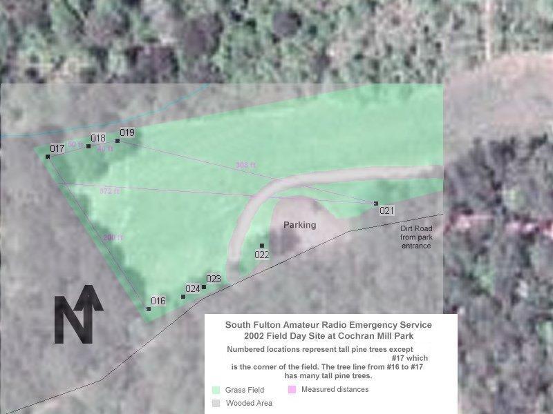
Location
of the Southwest end of the field.
This diagram illustrates a 500 ft radius circle with the extreme corner of the field on the edge in an effort to maximize the available ground within the ARRL rules. The rules specify a circle with a diameter of 1000 feet. |
|||||||||
 |
|||||||||
|
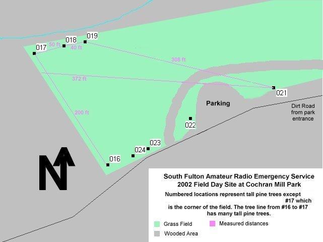
This is actual GPS data
for the Southwest end of the field. Waypoints: 016 N33.57179° W084.72221°; 017 N33.57226° W084.72260°; 018 N33.57230° W084.72244°; 019 N33.57232° W084.72233°; 021 N33.57212° W084.72136°; 022 N33.57199° W084.72179°. Obviously these are just for reference. |
|||||||||
 |
|||||||||
|
This is
an overlay of both the satellite photo and the GPS data showing the
Southwest end of the field
|
|||||||||
 |
|||||||||
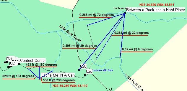
| Laurie - KG4FDM suggested we might look for the GeoCaches hid at the park. The details are: "Between a Rock and a Hard Place", N33 34.626 W84 42.511, and "Cache Me 'In' A Can", N33 34.240 W84 43.112. See the map above for placement in the park. See others at http://www.geocaching.com | |||||||||
| More Cochran Mill maps and pictures used to put together the composits you see on this page. | |||||||||

Updated: March 27, 2005 10:44